Atlas of the World/Physical and topographical

|
Wikimedia Commons Atlas of the World The Wikimedia Atlas of the World is an organized and commented collection of geographical, political and historical maps available at Wikimedia Commons. Discussion • Update the atlas • Index of the Atlas • Atlas in categories • Other atlases on line |
The introductions of the country, dependency and region entries are in the native languages and in English. The other introductions are in English.

World (physical and topographical)
|
Atlas of the World/Physical and topographical |
General maps

|
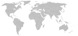
Blank map with international borders (Robinson projection) |

|
Topographic and bathymetric (unidentified pseudocylindrical, with Arctic and Antarctic insets) |
Topographic map of the world in tiles (shaded relief, equirectangular projection)
| 135°W | 45°W | 45°E | 135°E | |
| 45°N | 
|

|

|

|
| 45°S | 
|

|

|

|
| 165°W | 135°W | 105°W | 75°W | 45°W | 15°W | 15°E | 45°E | 75°E | 105°E | 135°E | 165°E | |
| 75°N | 
|

|

|

|

|

|

|

|

|

|

|

|
| 45°N | 
|

|

|

|

|

|

|

|

|

|

|

|
| 15°N | 
|

|

|

|

|

|

|

|

|

|

|

|
| 15°S | 
|

|

|

|

|

|

|

|

|

|

|

|
| 45°S | 
|

|

|

|

|

|

|

|

|

|

|

|
| 75°S | 
|

|

|

|

|

|

|

|

|

|

|

|

|
Political and physical map (Robinson projection) |

|
Political and physical map (Robinson projection) |

|
Elevation and bathymetry map (equirectangular projection) |
Notes and references
|
General remarks:
|