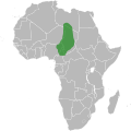
Category:Maps of Kanem Empire
Media in category "Maps of Kanem Empire"
The following 7 files are in this category, out of 7 total.
-
Afrika-Kanem-Bornu.png 585 × 600; 50 KB
-
Eastern Sahel in Politische Wandkarte von Africa im Maßstabe by Heinrich Kiepert.jpg 4,669 × 2,399; 9.71 MB
-
Kanem-Bornu 1650.svg 686 × 970; 1.43 MB
-
Kanem-Bornu-cropped.svg 869 × 458; 152 KB
-
Kanem-Bornu.svg 1,000 × 1,000; 189 KB
-
Rabih az-Zubayr State.svg 550 × 550; 274 KB
-
Rabih Azzubair Dominions.png 1,806 × 1,155; 1.09 MB


