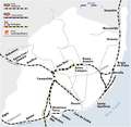
File:Metro Lisboa Route Map (only with routes in operation).png

Original file (1,316 × 1,231 pixels, file size: 192 KB, MIME type: image/png)
Captions
Captions

|
This map image could be re-created using vector graphics as an SVG file. This has several advantages; see Commons:Media for cleanup for more information. If an SVG form of this image is available, please upload it and afterwards replace this template with
{{vector version available|new image name}}.
It is recommended to name the SVG file “Metro Lisboa Route Map (only with routes in operation).svg”—then the template Vector version available (or Vva) does not need the new image name parameter. |
| DescriptionMetro Lisboa Route Map (only with routes in operation).png |
|
| Date | |
| Source |
Own work (Original text: Self made, using the information from) and using the following logos:
Created with Adobe Illustrator 12.0 If you ask for, I will give you the .ai-file or I'll correct it or create other language versions. |
| Author | Maximilian Dörrbecker (Chumwa) |
| Permission (Reusing this file) |
Maximilian Dörrbecker (Chumwa, the copyright holder of this work, hereby publishes it under the following license: This file is licensed under the Creative Commons Attribution-Share Alike 2.5 Generic license. Attribution: Maximilian Dörrbecker (Chumwa
Sie dürfen das Bild zu den folgenden Bedingungen nutzen:
|
| Other versions |
|
File history
Click on a date/time to view the file as it appeared at that time.
| Date/Time | Thumbnail | Dimensions | User | Comment | |
|---|---|---|---|---|---|
| current | 17:14, 21 June 2019 |  | 1,316 × 1,231 (192 KB) | Tuvalkin (talk | contribs) | New municipal borderline adding bits of Moscavide and Sacavém communes, formerly in Loures municipality. (Not really new, but this got reverted in the previous upload.) |
| 17:54, 27 May 2016 |  | 1,316 × 1,231 (166 KB) | Chumwa (talk | contribs) | Verlängerung nach Reboleira eröffnet | |
| 00:13, 25 June 2013 |  | 1,316 × 1,231 (192 KB) | Tuvalkin (talk | contribs) | New municipal borderline adding bits of Moscavide and Sacavém communes (formerly in Loures municipality). | |
| 04:45, 31 July 2012 |  | 1,316 × 1,231 (167 KB) | Chumwa (talk | contribs) | Strecke zum Flughafen ist jetzt eröffnet | |
| 08:12, 25 October 2009 |  | 1,316 × 1,231 (181 KB) | Chumwa (talk | contribs) | Amadora Este - Reboleira als im Bau befindlich ergänzt | |
| 16:23, 24 October 2009 |  | 1,316 × 1,231 (178 KB) | Chumwa (talk | contribs) | {{Information |Description= *{{ de }} Streckennetz der Metro Lissabon *{{ en }} Metro Lisboa Route Map *{{ fr }} Plan du métro de Lisbonne *{{ pt }} Mapa do Metro de Lisboa *{{ uk }} Cхема ліній Лісабонського метрополіте� |
You cannot overwrite this file.
File usage on Commons
The following 26 pages use this file:
- User:Albedo-ukr/Infographics
- User:Chumwa/Gallery
- User:Chumwa/OgreBot/Potential transport maps/2016 May 21-31
- User:Chumwa/OgreBot/Potential transport maps/2019 June 21-30
- User:Chumwa/OgreBot/Public transport information/2016 May 21-31
- User:Chumwa/OgreBot/Public transport information/2019 June 21-30
- User:Chumwa/OgreBot/Transport Maps/2016 May 21-31
- User:Chumwa/OgreBot/Transport Maps/2019 June 21-30
- User:Chumwa/OgreBot/Travel and communication maps/2016 May 21-31
- User:Chumwa/OgreBot/Travel and communication maps/2019 June 21-30
- User:Jcornelius/Portugal Public Transport/2016 May 21-31
- User:Jcornelius/Portugal Public Transport/2019 June 21-30
- File:573px-Metro Lisboa Route Map.png (file redirect)
- File:Linha de Cintura.png
- File:Lisboa rail&underground routes map 2012.png
- File:Lisboa railway junction.png
- File:Map of the Terceira Travessia do Tejo.png
- File:Metro Lisboa Route Map.png
- File:Metro Lisboa Route Map (only with routes in operation).png
- File:Metro Lisboa with suburban railway lines.png
- File:Metro Lisboa with suburban railway lines blank.PNG
- File:StrassenbahnGleisplanLisboa1995(angeschlossen).png
- File:StrassenbahnGleisplanLisboa1995.png
- Category:Lines of Lisbon Metro
- Category:Lisbon Metro
- Category:Maps of Lisbon Metro
File usage on other wikis
The following other wikis use this file:
- Usage on be-tarask.wikipedia.org
- Usage on bn.wikipedia.org
- Usage on cs.wikipedia.org
- Usage on cs.wikivoyage.org
- Usage on de.wikipedia.org
- Usage on de.wikiversity.org
- Usage on en.wikipedia.org
- Usage on en.wikivoyage.org
- Usage on es.wikipedia.org
- Usage on eu.wikipedia.org
- Usage on fa.wikipedia.org
- Usage on fi.wikivoyage.org
- Usage on fr.wikipedia.org
- Usage on ga.wikipedia.org
- Usage on gl.wikipedia.org
- Usage on hu.wikipedia.org
- Usage on id.wikipedia.org
- Usage on incubator.wikimedia.org
- Usage on it.wikipedia.org
- Usage on ja.wikipedia.org
- Usage on nl.wikipedia.org
- Odivelas (metrostation)
- Rato (metrostation)
- Oriente (metrostation)
- Alameda (metrostation)
- Cabo Ruivo (metrostation)
- Olivais (metrostation)
- Chelas (metrostation)
- Bela Vista (metrostation)
- Olaias (metrostation)
- Saldanha (metrostation)
- Amadora Este (metrostation)
- Alfornelos (metrostation)
- Pontinha (metrostation)
- Carnide (metrostation)
- Colégio Militar/Luz (metrostation)
- Alto dos Moinhos (metrostation)
- Laranjeiras (metrostation)
- Jardim Zoológico (metrostation)
- Praça de Espanha (metrostation)
- São Sebastião (metrostation)
- Parque (metrostation)
- Senhor Roubado (metrostation)
- Ameixoeira (metrostation)
View more global usage of this file.
Metadata
This file contains additional information such as Exif metadata which may have been added by the digital camera, scanner, or software program used to create or digitize it. If the file has been modified from its original state, some details such as the timestamp may not fully reflect those of the original file. The timestamp is only as accurate as the clock in the camera, and it may be completely wrong.
| Horizontal resolution | 78.74 dpc |
|---|---|
| Vertical resolution | 78.74 dpc |


