File:Syrian Civil War map.svg

Original file (SVG file, nominally 922 × 762 pixels, file size: 3.56 MB)
Captions
Captions
| This image relies on colours to convey information. However, the colours used make it difficult or even impossible for people with colour blindness (at least deuteranomaly and maybe others) to read the information. Please consider changing the colours to meet the needs of a wider audience. A more precise description of the problem: Many of the colours are so similar in the map that it is impossible match them to the legend English ∙ British English ∙ Español ∙ français ∙ македонски ∙ português do Brasil ∙ русский ∙ українська ∙ 中文(简体) ∙ 中文(繁體 ∙ +/− |
Summary
[edit]
|
This file may be updated to reflect new information. If you wish to use a specific version of the file without it being overwritten, please upload the required version as a separate file. |
| DescriptionSyrian Civil War map.svg |
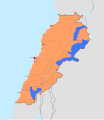
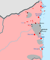
English: Map of the Syrian Civil War. Español: Mapa de la Guerra civil siria
Information to readers: Click on the image to make marks and icons visible, which are otherwise too small. To zoom into the image after you opened it, hold ctrl and scroll in/out with your mouse. To view the image in full quality, open it in Media Viewer, download the original file and open it with Inkscape (free drawing program). If you want to see the history of the Syrian Civil War before August 2016, look at Syrian civil war.png.
|
||||
| Map legend |
Bahasa Indonesia: Bosanski: Català: Čeština: Dansk: Deutsch:
English:
Español:
Euskara: Français :
Hrvatski: Italiano:
Magyar: Nederlands: Polski:
Português: Română: Shqip: Slovenščina: Tiếng Việt: Türkçe:
Ελληνικά: Беларуская (тарашкевіца): Български: Русский:
Српски (ћирилица): Українська: ქართული: Հայերեն : संस्कृतम् : 한국어: 中文: 閩南語 / Bân-lâm-gú:
עברית : العربية : تۆرکجه :
فارسی : کوردی (عەرەبی): |
||||
| Date |
between 2011 and 2018 date QS:P,+2011-00-00T00:00:00Z/8,P1319,+2011-00-00T00:00:00Z/9,P1326,+2018-00-00T00:00:00Z/9 |
||||
| Source |
Own work, derived from the Template:Syrian Civil War detailed map.
|
||||
| Creator | |||||
| Georeferencing | Georeference the map in Wikimaps Warper If inappropriate please set warp_status = skip to hide. | ||||
| Other versions |
Note: Comments "areas of activity" means that this is not territorial control is shown.
|
Licensing
[edit]- You are free:
- to share – to copy, distribute and transmit the work
- to remix – to adapt the work
- Under the following conditions:
- attribution – You must give appropriate credit, provide a link to the license, and indicate if changes were made. You may do so in any reasonable manner, but not in any way that suggests the licensor endorses you or your use.
- share alike – If you remix, transform, or build upon the material, you must distribute your contributions under the same or compatible license as the original.
File history
Click on a date/time to view the file as it appeared at that time.
| Date/Time | Thumbnail | Dimensions | User | Comment | |
|---|---|---|---|---|---|
| current | 09:04, 1 February 2024 |  | 922 × 762 (3.56 MB) | TKsdik8900 (talk | contribs) | Fulfilling the upload request (File talk:Syrian Civil War map.svg#Edit request) by Ecrusized |
| 20:25, 12 January 2023 |  | 922 × 762 (10.27 MB) | Achim55 (talk | contribs) | Reverted to version as of 18:19, 9 September 2021 (UTC) | |
| 19:58, 12 January 2023 |  | 923 × 764 (10.27 MB) | Achim55 (talk | contribs) | Reverted to version as of 18:07, 12 January 2023 (UTC) | |
| 19:52, 12 January 2023 |  | 922 × 762 (3.73 MB) | Ecrusized (talk | contribs) | You've cited a template that does not cite any sources, but your changes do not even match that. There is no SAA presence in AANES outside of Turkish border areas. | |
| 18:07, 12 January 2023 |  | 923 × 764 (10.27 MB) | Контфокк (talk | contribs) | Amending NE border holdings, fixing "gray spots" between colors | |
| 17:42, 12 January 2023 |  | 923 × 764 (10.27 MB) | Контфокк (talk | contribs) | Reverted to version as of 21:11, 2 January 2023 (UTC) The map template – which is clarified in the description to be the only source, as it has been since 2016. Take it to the talk page. | |
| 10:40, 10 January 2023 |  | 922 × 762 (10.27 MB) | Ecrusized (talk | contribs) | Reverted to version as of 18:19, 9 September 2021 (UTC) Source for changing Idlib? | |
| 21:11, 2 January 2023 |  | 923 × 764 (10.27 MB) | Контфокк (talk | contribs) | Update to January 2023 | |
| 18:19, 9 September 2021 |  | 922 × 762 (10.27 MB) | Rubin16 (talk | contribs) | Reverted to version as of 18:58, 8 September 2021 (UTC) | |
| 15:56, 9 September 2021 |  | 922 × 762 (10.27 MB) | Detoxtexts (talk | contribs) | Reverted to version as of 12:08, 9 September 2021 (UTC) Uncited changes and attacking for no clear reason instead of explaining the reason for the change. |
You cannot overwrite this file.
File usage on Commons
More than 100 pages use this file. The following list shows the first 100 pages that use this file only. A full list is available.
- User:Ermanarich
- User:Hermes79
- User:Hermes7979
- User:Magog the Ogre/Maps of conflicts/2016 August
- User:Magog the Ogre/Maps of conflicts/2016 September
- File:2013 Hama Offensive.svg
- File:2015 Latakia Frontlines.svg
- File:Aleppo Offensives 2015.svg
- File:Armed conflict zones in Myanmar.png
- File:Attaques-terroristes-meurtrières-au-21eme-siecle.png
- File:Battle of Daraa City.svg
- File:Battle of Hasakah.svg
- File:Battle of Qamishli.svg
- File:Battle of Raqqa.svg
- File:Battle of Tadmur.svg
- File:Battle of Western Qalamoun.svg
- File:Battlefields in The Global War on Terror.svg
- File:Battlefields in The Global War on Terror - edit03.png
- File:Battlefields in The Global War on Terror - edit04.png
- File:Benghazi Conflict Detailed Map.png
- File:Benghazi Conflict Detailed Map.svg
- File:Boko Haram insurgency map.svg
- File:Countries by soldier count.svg
- File:Deir ez-Zor clashes (2017).svg
- File:East Congo conflict map.svg
- File:GSPC map.png
- File:ISIS (Grey) Territory Change 2014-2016.gif
- File:Iraqi Civil War map (2014–present).png
- File:Islamist insurgency in Nigeria.svg
- File:Lebanese insurgency.png
- File:Lebanese insurgency.svg
- File:Libyan Civil War.svg
- File:Libyan war final-fr.svg
- File:Map of Ongoing conflicts around the world.png
- File:Map of terror of the Islamic State (ad-Daula al-islāmiyya).png
- File:Mexico states map small war.PNG
- File:Mosul offensive (2015) map.png
- File:Number of Terrorist Incidents.png
- File:Ongoing Conflicts (1).png
- File:Ongoing conflicts around the world.svg
- File:Pakistan-Waziristan-Map.png
- File:Political map Afar triangle.png
- File:Rif Damashq.svg
- File:Siege of Homs Map.svg
- File:Sinai insurgency.svg
- File:Somali Civil War (2009-present).svg
- File:Southern Sudan Civil War.svg
- File:Sudanese Internal Conflict.svg
- File:Syria and Iraq 2014-onward War map.png
- File:Syrian, Iraqi, and Lebanese insurgencies.png
- File:Syrian Civil War map.svg
- File:Syrian civil war.png
- File:Tadmur offensive (2015).jpg
- File:Territorial changes after 2016 Armenian-Azerbaijani clashes.jpg
- File:Turkish-PKK rebellion.svg
- File:War in North-West Pakistan.svg
- File:World2s.png
- File:Yemeni Civil War.svg
- File:Zones de conflit en Birmanie.png
- File:Саудовско-йеменский конфликт.png
- Template:Ongoing civil wars (maps)
- Category:2015 military intervention in Yemen
- Category:2016 Armenian–Azerbaijani clashes
- Category:Attack
- Category:Battle of Aleppo
- Category:Battles in 2016
- Category:Battles of Syria
- Category:Battles of the Syrian Civil War
- Category:Civil wars
- Category:Conflicts
- Category:Conflicts by continent
- Category:Conflicts by country
- Category:Conflicts by type
- Category:Current civil wars maps
- Category:Feuds
- Category:Fights
- Category:Liberation of Palmyra (2016)
- Category:Maps of Somali Civil War
- Category:Maps of conflicts
- Category:Maps of disputed territories
- Category:Maps of terrorism
- Category:Maps of the 2014 pro-Russian unrest in Ukraine
- Category:Maps of the Demilitarized Zone of Korea
- Category:Maps of the Syrian Civil War in 2016
- Category:Maps of the War in Afghanistan (2001–2021)
- Category:Maps of wars
- Category:Military conflicts
- Category:Military maps of the world
- Category:Ongoing armed conflicts
- Category:Quarrels
- Category:Rebellions
- Category:Riots
- Category:Schisms
- Category:Syrian Civil War
- Category:Terrorism
- Category:Uprisings
- Category:War
- Category:War casualties
- Category:Warfare by type
- Category:Wars
View more links to this file.
File usage on other wikis
The following other wikis use this file:
- Usage on ar.wikipedia.org
- Usage on arz.wikipedia.org
- Usage on dag.wikipedia.org
- Usage on en.wikipedia.org
- List of non-international armed conflicts
- Talk:Revolutionary Commando Army
- User:Crewcamel/sandbox
- Wikipedia:Top 25 Report/April 2 to 8, 2017
- Talk:Syrian civil war/Archive 44
- Talk:Control of cities during the Syrian civil war/Archive 65
- Talk:Islamic State/Archive 41
- Wikipedia:Top 25 Report/February 25 to March 3, 2018
- Wikipedia:Wikipedia Signpost/2018-03-29/Traffic report
- Wikipedia:Wikipedia Signpost/Single/2018-03-29
- User:Mhxyqwe123/sandbox
- User:CubanoBoi/sandbox12
- User:S0V3R31GNN0RT0N/sandbox
- User:PanNostraticism2/sandbox
- Talk:Syrian civil war/Archive 51
- Usage on es.wikipedia.org
- Usage on fr.wikipedia.org
- Usage on he.wikipedia.org
- Usage on it.wikipedia.org
- Usage on tr.wikiquote.org
- Usage on www.wikidata.org
Metadata
This file contains additional information such as Exif metadata which may have been added by the digital camera, scanner, or software program used to create or digitize it. If the file has been modified from its original state, some details such as the timestamp may not fully reflect those of the original file. The timestamp is only as accurate as the clock in the camera, and it may be completely wrong.
| Width | 921.83002 |
|---|---|
| Height | 761.91602 |


