File:Norwegian Sea map ch.png
From Wikimedia Commons, the free media repository
Jump to navigation
Jump to search

Size of this preview: 657 × 600 pixels. Other resolutions: 263 × 240 pixels | 526 × 480 pixels | 1,000 × 913 pixels.
Original file (1,000 × 913 pixels, file size: 365 KB, MIME type: image/png)
File information
Structured data
Captions
Captions
Add a one-line explanation of what this file represents
Summary
[edit]| DescriptionNorwegian Sea map ch.png |
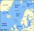
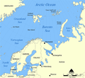
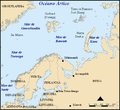
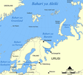
中文(繁體):中文描述图片,挪威海、格陵兰海、法罗群岛、设德兰群岛、丹麦海峡、扬马延岛 |
| Date | |
| Source | File:Norwegian Sea blank map.png |
| Author | User:NormanEinstein |
| Permission (Reusing this file) |
Creative Commons Attribution ShareAlike 3.0 |
| Other versions |
[edit]
|
Licensing
[edit]This file is licensed under the Creative Commons Attribution-Share Alike 3.0 Unported license.
- You are free:
- to share – to copy, distribute and transmit the work
- to remix – to adapt the work
- Under the following conditions:
- attribution – You must give appropriate credit, provide a link to the license, and indicate if changes were made. You may do so in any reasonable manner, but not in any way that suggests the licensor endorses you or your use.
- share alike – If you remix, transform, or build upon the material, you must distribute your contributions under the same or compatible license as the original.
File history
Click on a date/time to view the file as it appeared at that time.
| Date/Time | Thumbnail | Dimensions | User | Comment | |
|---|---|---|---|---|---|
| current | 09:06, 8 March 2010 |  | 1,000 × 913 (365 KB) | Irrons (talk | contribs) | {{Information |Description={{zh-hant|1=中文描述图片,挪威海、格陵兰海、法罗群岛、设德兰群岛、丹麦海峡、扬马延岛}} |Source=File:Norwegian Sea blank map.png |Author=User:NormanEinstein |Date=2005-10-31 |Permission=Creativ |
You cannot overwrite this file.
File usage on Commons
The following 29 pages use this file:
- File:Bahari ya Barents.png
- File:Barents Sea map.png
- File:Barents Sea map GR.png
- File:Barents Sea map hr.svg
- File:Barents Sea map hu.svg
- File:Barents Sea map ru.svg
- File:Barents sea map blank.png
- File:Barents sea map de.png
- File:Barents sp.png
- File:Carte de la mer de Norvège-Jan-Mayen-localisation.png
- File:Carte de la mer de Norvège.png
- File:Karte Europäisches Nordmeer.png
- File:Norra meri.png
- File:Norveško more.svg
- File:Norvég-tenger térkép 2.png
- File:Norvég tenger térkép.png
- File:Norwegian Sea blank map.png
- File:Norwegian Sea map-da.png
- File:Norwegian Sea map.png
- File:Norwegian Sea map ce.svg
- File:Norwegian Sea map ch.png
- File:Norwegian Sea map cs.png
- File:Norwegian Sea map it.png
- File:Norwegian Sea map mk.svg
- File:Norwegian Sea map no.png
- File:Norwegian Sea map ru.svg
- File:Norwegian Sea map sv.png
- File:Norwegian Sea map uk.svg
- Template:Other versions/Norwegian Sea


