Category:Maps of Zanzibar
Jump to navigation
Jump to search
Wikimedia category | |||||
| Upload media | |||||
| Instance of | |||||
|---|---|---|---|---|---|
| Category combines topics | |||||
| Zanzibar Islands | |||||
semi-autonomous part of Tanzania | |||||
| Instance of | |||||
| Location | Tanzania | ||||
| Capital | |||||
| Official language | |||||
| Anthem | |||||
| Currency |
| ||||
| Head of government | |||||
| Present in work |
| ||||
| Inception |
| ||||
| Population |
| ||||
| Area |
| ||||
| Different from | |||||
 | |||||
Subcategories
This category has the following 5 subcategories, out of 5 total.
Pages in category "Maps of Zanzibar"
This category contains only the following page.
Media in category "Maps of Zanzibar"
The following 46 files are in this category, out of 46 total.
-
Map of Zanzibar Archipelago-no.svg 628 × 794; 817 KB
-
Topographic map of Zanzibar-en.svg 420 × 605; 409 KB
-
Zanzibar (tanzania).jpg 354 × 522; 44 KB
-
Admiralty Chart No 3309 Fanjove Island to Dar Es Salaam, Published 1967.jpg 11,282 × 16,357; 15.82 MB
-
Admiralty Chart No 3310 Dar Es Salaam to Wasin Island, Published 1966.jpg 11,234 × 16,442; 22.19 MB
-
Admiralty Chart No 665 Approaches to Zanzibar, Published 1956.jpg 11,303 × 16,480; 39.74 MB
-
Agriculture of Zanzibar.png 704 × 523; 604 KB
-
Jozani forest.png 395 × 309; 31 KB
-
Map of Zanzibar Archipelago ru.svg 628 × 794; 832 KB
-
Map of Zanzibar Archipelago-de.svg 628 × 794; 816 KB
-
Map of Zanzibar Archipelago-en.svg 628 × 794; 817 KB
-
Map of Zanzibar Archipelago-eu.svg 889 × 1,124; 485 KB
-
Map of Zanzibar Archipelago-fi.svg 628 × 794; 815 KB
-
Map of Zanzibar Archipelago-mk.svg 628 × 794; 835 KB
-
Map of Zanzibar Archipelago-sv.svg 628 × 794; 815 KB
-
Map of Zanzibar be.svg 400 × 601; 28 KB
-
Map of Zanzibar.svg 400 × 601; 21 KB
-
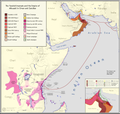
Omani Empire 2.png 4,645 × 4,399; 2.21 MB
-
Pemba Island (Tanzania).jpg 354 × 670; 76 KB
-
Sansibarin kartta.svg 400 × 601; 21 KB
-
Sansibarlocation.png 330 × 351; 38 KB
-
Spice Islands (Tanzania)-HE.svg 713 × 879; 19 KB
-
Spice Islands (Tanzania).jpg 284 × 356; 29 KB
-
Spice Islands (Tanzania).svg 713 × 879; 15 KB
-
Spice Islands (Zanzibar highlighted) el.svg 713 × 879; 27 KB
-
Spice Islands (Zanzibar highlighted) sv.svg 713 × 879; 18 KB
-
Spice Islands (Zanzibar highlighted)-ar.svg 713 × 879; 29 KB
-
Spice Islands (Zanzibar highlighted)-es.svg 713 × 879; 25 KB
-
Spice Islands (Zanzibar highlighted)-sr.svg 713 × 879; 24 KB
-
Spice Islands (Zanzibar highlighted).svg 713 × 879; 11 KB
-
Spice Islands Tanzania-es.svg 713 × 879; 25 KB
-
Spice Islands Tanzania-fr.svg 713 × 879; 24 KB
-
Spice Islands-Zanzibar highlighted-fr.svg 713 × 879; 24 KB
-
Sultanate of Kilwa.png 1,819 × 2,739; 1.57 MB
-
Topographic map of Zanzibar-de.svg 590 × 820; 412 KB
-
Topographic map of Zanzibar-hu.svg 400 × 601; 61 KB
-
Topographic map of Zanzibar-mk.svg 420 × 605; 901 KB
-
Topographic map of Zanzibar-no.svg 420 × 605; 406 KB
-
Topographic map of Zanzibar-sr.svg 400 × 601; 78 KB
-
Zanzibar-north-districts.png 750 × 1,264; 25 KB
-
UngujaZanzibar2021OSM.png 6,666 × 10,200; 15.48 MB
-
Zanzibar and Pemba - DPLA - 46efee52b2799fd085cc86bc7f7018e9.jpg 2,556 × 3,276; 5.21 MB
-
Zanzibar and Pemba Islands.jpg 849 × 1,677; 322 KB
-
ZanzibarPemba2021OSM.png 5,000 × 7,613; 3.71 MB
-
Занзібар.svg 628 × 794; 835 KB
-
سلطنة كلوة.png 1,819 × 2,739; 1.68 MB


