Category:Maps of volcanoes in Indonesia
Jump to navigation
Jump to search
Subcategories
This category has the following 10 subcategories, out of 10 total.
*
B
- Maps of Mount Bromo (2 F)
K
- Krakatoa evolution maps (3 F)
M
- Maps of the Dieng Plateau (2 F)
- Maps of Mount Merapi (8 F)
T
Media in category "Maps of volcanoes in Indonesia"
The following 26 files are in this category, out of 26 total.
-

-
 Bali Mts Agung and Batur.jpg 1,400 × 704; 106 KB
-
 Bromo eruption MODIS20110127pm.jpg 1,833 × 1,416; 426 KB
-
 Cagar Alam Rawa Danau Caldera.png 937 × 552; 819 KB
-
 Ijen-Umgebung.JPG 1,511 × 1,508; 668 KB
-
 Ijen.JPG 1,800 × 1,418; 1.13 MB
-

-
 Junghuhn Dieng.jpg 2,728 × 1,969; 1.3 MB
-
 Junghuhns Java-Karte Drittes Blatt.jpg 5,990 × 6,215; 9.9 MB
-
 Junghuhns Java-Karte Erstes Blatt.jpg 6,084 × 6,204; 9.07 MB
-
 Junghuhns Java-Karte Viertes Blatt.jpg 6,088 × 6,259; 8.26 MB
-
 Junghuhns Java-Karte Zweites Blatt.jpg 5,987 × 6,195; 10.27 MB
-
 Junghuhns Java-Karte.jpg 9,000 × 2,290; 3.99 MB
-
 Kawah Ijen.JPG 1,503 × 1,500; 516 KB
-
 Map indonesia volcanoes.gif 731 × 410; 25 KB
-
 Map indonesia volcanoesRU.gif 731 × 410; 24 KB
-
 Raung-Krater mit Bergsturz.JPG 938 × 642; 209 KB
-
 Sumatra Volcanoes.png 600 × 527; 141 KB
-
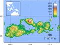 Sumbawa Topography.png 2,440 × 1,860; 1.91 MB
-
 Tambora ashfall 1815.svg 1,770 × 1,300; 199 KB
-
 Tengger-Gebirge.JPG 2,400 × 1,599; 1.11 MB
-
 The earth and its inhabitants (1890) (21115390702).jpg 1,732 × 1,876; 1.14 MB
-
 Topography of Bali-SUBAK.jpg 1,576 × 1,076; 238 KB
-
 Topography of Bali.jpg 1,669 × 1,217; 498 KB
-
 Vulkane in Ostjava-Junghuhn.jpg 2,909 × 1,797; 555 KB
-
 Окрестности вулкана Агунг.png 1,160 × 847; 987 KB


_(21115390702).jpg)


.jpg)