Death Valley National Park
Jump to navigation
Jump to search
Death Valley National Park is a mostly arid National Park located east of the Sierra Nevada mountain range in Inyo County, California, USA with a small section extending into Nevada. (![]() Featured article)
Featured article)
Maps
[edit]-
Location Death Valley National Park
-
Death Valley National Park map showing old park extent and mines (red dots)
-
by United States Geological Survey (USGS)
-
Free map by National Park Service, Harpers Ferry Center, publication
From Space Satellite View
[edit]-
from Space Shuttle Columbia, during Mission STS-73
-
Desert view from Landsat 7
-
Desert view from Landsat 7
Roads
[edit]-
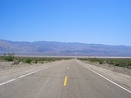
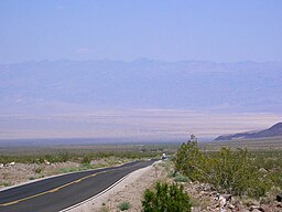
Road in Death Valley
-
Road in Death Valley National Park
-
Road in Death Valley National Park
-
Road in Death Valley National Park
-
Road in Death Valley National Park
-
Radiator water tank on the desert road
-
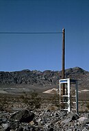
Telephon box on the desert road
-
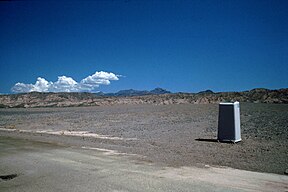
Chemical water closed on the desert road
-
Desert incoming near Shoshones
-
Desert sand road mud near Shoshones to Greenwater Valley
-
Jubilee Pass at down
-
Twenty Mule Team Canyon
-
Road to Zabriskie Point, Death Valley
-
View of Death Valley from Hells Gate, and access roads to California SR 190
Dunes
[edit]-
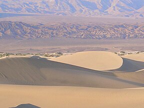
Dunes in Death Valley National Park
-
Dunes in Death Valley National Park
-
Dunes in Death Valley National Park
-
Dunes in Death Valley National Park
-
Mesquite Sand Dunes
-
Desert dunes near Stovepipe Wells
-
Looking east towards Nevada
Zabriskie Point
[edit]-
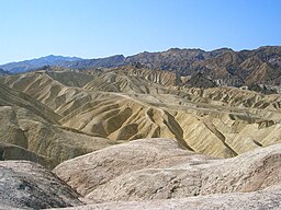
Zabriskie Point July 2007
-
Zabriskie Point 2007
-
Zabriskie Point
-
Manly Beacon, Zabriskie Point
-
Zabriskie Point
-
Zabriskie Point 1998
-
Zabriskie Point 1998
-
Zabriskie Point 2003
-
Gower Gulch, arid river fludge from Zabriskie Point
-
Gover Gulch, badlands area at rise from Zabriskie Point
-
Gower Gulch, badlands at rise from Zabriskie Point
-
Zabriskie Christian Brevoort sign at Zabriskie Point
-
Manly Beacon and Red Cathedral at rise from Zabriskie Point
-
Red Cathedral at rise from Zabriskie Point
-
Tourist Parking at Zabriskie Point
-
Zabriskie Point at sunrise
-
Hikers entering Gower Gulch
Animals and Plants
[edit]-
Birds at Stovepipe Wells Campground
-
Bird at Stovepipe Wells Campground
-
Coyote in Death Valley
-
Atriplex hymenelytra (Desert holly) near Ubehebe crater
-
Chuckwalla o Chuckawalla (Sauromalus Obesus)
-
Greater Roadrunner at Death Valley National Park, California.
-
Profuse flowers after a wet winter, 2005
Dante's View
[edit]-
Dante's view
-
Salt Shoreline from Dante's view
-
Salt deposit from Dante's view
-
Shoreline closup from Dante's view
-
Shoreline closup from Dante's view
-
Death Valley from Dante's view to North
-
Death Valley from Dante's View to South
-
Hanaupah salt fludge, from Dante's View to West
-
Panorama of Death Valley from Dante's View
Furnace Creek
[edit]-
Furnace Creek oasis
-
Campground near Texas Spring at Furnace Creek
-
Sea level near Furnace Creek
-
Solar collectors at Furnace Creek
Badwater
[edit]Main gallery: Badwater.
-
Devil's golf
-
Devil's golf daylight
-
Devil's Golf Course
-
Devil's Golf Course
-
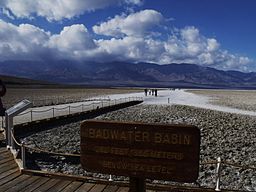
Badwater Basin
-
Badwater Road, old salt lake at down near Shore Line Butte
-
Badwater, lowest point in the USA
-
Sea Level
-
From Badwater view to North
-
Badwater
-
Badwater
-
Badwater Basin View
-
View from Badwater Basin
-
Sea Level sign seen on cliff (circled in red) at Badwater Basin
-
Elevation sign and scenery.
Ubehebe Crater
[edit]-
Ubehebe Crater up
-
Cinder field near Ubehebe Crater
-
Ubehebe Crater
-
Ubehebe Crater up
Petroglyphs
[edit]-
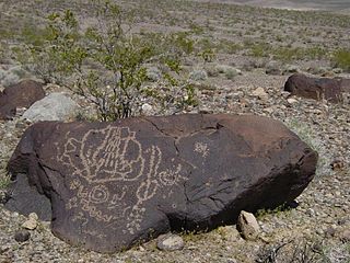
Petroglyphs above Mesquite Springs
-
Petroglyphs, Marble Canyon
-
Petroglyphs, Titus Canyon
Marble Canyon
[edit]-
Petroglyphs, Marble Canyon
Artist's palette
[edit]Miscellaneous
[edit]-
Racetrack Playa, view from south edge of the playa towards The Grandstand
-
Golden canyon
-
Mini alluvial fan at Salt Creek
-
Gigantic alluvial fan uplift by new fault
-
Perpendicularly fused metamorphosed sedimentary layers at Mosaic Canyon
-
High and low points in Death Valley National Park
-
Panamint Range looking toward Telescope Peak
-
Mine at Leadfield
-
Ventifact at Ventifact Ridge
-
Ventifact at Ventifact Ridge
-
Sidewinder Canyon
-
Abandoned radiator water tank near Grapevine


